
Mapping the Future: How BMRG Uses GIS to Drive Conservation and Sustainability
Geographic Information Systems (GIS) is a transformative technology that enables the collection, management, analysis, and mapping of various types of data. At Burnett Mary Regional Group (BMRG), a Natural Resource Management (NRM) organisation, we leverage GIS to enhance environmental conservation efforts, support landholders, and drive sustainable resource management.
GIS is more than just mapping—it is a powerful tool for visualising and analysing spatial relationships within data. It is used to create maps, analyse patterns, communicate insights, and support planning efforts. A useful analogy is that GIS works like a "hamburger with the lot," where each layer of data is like an ingredient, and analysing them together provides a complete picture.

Distribution of the Subtropical Eucalypt Floodplain Forest and Woodland as identified by the Department of Climate Change, Energy, the Environment and Water (DCCEEW). Areas where the ecological community is likely to occur and may occur are highlighted.

Mapped Regional Ecosystems (REs) associated with Subtropical Eucalypt Floodplain Forest and Woodland, as classified by the Department of Environment and Science (DES). These REs provide a finer-scale representation of the ecosystem's distribution.
One example of GIS in action at BMRG is mapping potential habitats for threatened ecological communities. By analysing different spatial layers, we can identify areas where conservation efforts should be focused. Similarly, GIS helps prioritise seagrass and mangrove restoration, assess freshwater lakes on K’gari, model water tables, improve habitat models for threatened ecological communities, and map potential habitats for endangered species.
We also use GIS to manage riverine restoration sites through drone imagery, measure flood impacts on these areas, and produce property maps for landholders, showing key land management features such as grazing zones, vegetation types, boundaries, fences, and watering points. GIS plays a crucial role in these initiatives by integrating diverse datasets to support informed decision-making.

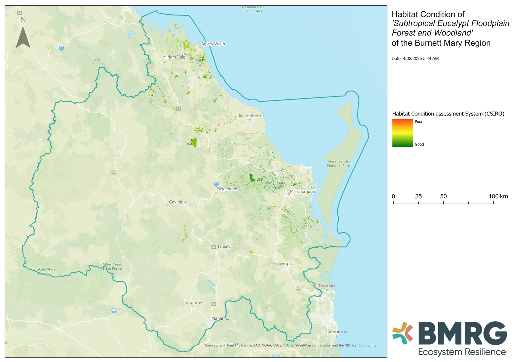
Habitat condition assessment by CSIRO, indicating the quality of habitat across the region. Green areas represent better-condition habitat, while peach areas indicate poorer-condition habitat.
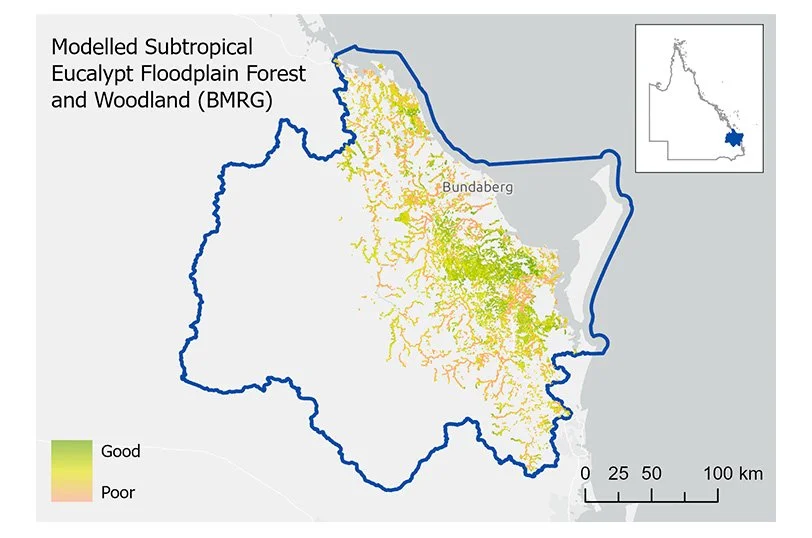
BMRG’s modelled distribution of the Subtropical Eucalypt Floodplain Forest and Woodland, incorporating regional datasets and habitat condition. Areas of higher-quality habitat are shown in green, while degraded areas are highlighted in peach.
As GIS technology continues to evolve, BMRG remains committed to using it to protect and restore natural landscapes, support landholders, and promote sustainable environmental management. By harnessing the power of spatial analysis, we empower communities and enhance conservation efforts for the future.

Result of layering several maps together.